
Starting a Rocklin Street Directory
Searching a Rocklin street begins with the address, not a broad name list. Placer County ties an address to a parcel, an owner record, and a legal description. The useful trail then moves through deeds, permits, maps, and older directories. A current owner is not the same as every person who uses an address, so each result needs a date and source. The steps below keep a street directory anchored to the place while leaving the California voter tool in its proper role.
- Run the full physical address through the Placer County Parcel, Zoning & Land Use Map, select the matched parcel, and capture its APN or assessment number.
- Open Placer Assessment Inquiry or Property Details with the 12-digit Assessment Number or Fee Parcel Number. The ordinary public inquiry has no unrestricted owner-name box.
- Pan the same street in the GIS viewer, turn on the parcel layer, and click nearby polygons. Keep the subject parcel, APN, situs address, and subdivision or lot context in one ledger.
- Search the Placer County Clerk-Recorder index by current grantee, then test the prior grantor with the document type, recording date, document number, or book and page.
- Use California My Voter Status only for a voter's personal check. For older household clues, compare address-based directories, census pages, newspapers, and cemetery records.
This order matters. GIS supplies the assessor key, the assessor supplies a dated parcel picture, and the recorder supplies title references. City files and older directories add people who may never appear in ownership data. A street directory is strongest when sources agree on place and time.
Rocklin Address Records by Street
Rocklin address records are split among county, city, election, and historical custodians. A map places the lot, an assessor record adds tax and mailing fields, a deed identifies instrument parties, and a permit shows a project trail. None alone is a live household roll.
| Record source | Custodian | Street-level evidence | Access route |
|---|---|---|---|
| Assessment roll | Placer Assessor | Owner, mailing, situs, values, exemptions, characteristics | Identifier lookup or data order |
| Parcel and land-use GIS | Placer County GIS/CDRA | APNs, parcel edges, zoning, land use, adjoining lots | Free map viewer |
| Recorded deeds and liens | Clerk-Recorder | Grantor, grantee, legal description, recording data | Free index; office image or copy |
| Tax bill record | Treasurer-Tax Collector | Assessment, installments, amount, payment status | 12-digit identifier search |
| Building and planning files | City of Rocklin | Project address, APN, owner, applicant, contractor, work | Online file or focused request |
| Voter status | California Secretary of State | The submitting voter's own registration and election status | Personal verification only |
| Directories and census | Libraries and archives | Year-specific people, occupations, addresses, and households | Library, archive, or digitized collection |
The APN bridges the county map, assessment fields, permits, and a recorded deed. Retain the legal description and printed address when a street name varies. Placer situs exports omit ZIP, so validate it through USPS ZIP Code Lookup.
Rocklin Street Assessment Fields
The public Assessment Inquiry is an identifier-led tool. The ordinary Property Details path accepts a 12-digit Assessment Number or a 12-digit Fee Parcel Number, while the assessor map can begin with an address, APN, book, or book-and-page reference. This makes GIS the practical first stop for a street search. Capture the key before moving between the map and the property record.
| Portal area | Fields or controls | What the result supports |
|---|---|---|
| Assessment Inquiry | 12-digit Assessment Number or Fee Parcel Number | Property Details lookup; no free owner-name field |
| Assessor Index Map | Address, APN, Book, Book and Page | Parcel location and current or historic map links |
| Property details | APN, TRA, land use, land and structure values, taxability, exemptions | Dated tax and parcel context |
| Physical fields | Building type, square footage, year built, garage, unfinished area, bedrooms, baths, fireplaces, pools | Characteristics tied to the parcel record |
| Transfer fields | Last recording date and current document number | A lead into the recorder index, not the deed image |
| Custom data request | Owner and mailing, situs, values, exemptions, characteristics, last transfer and deed fields | Ordered data; stated two-week completion |
| GIS controls | Address or parcel search, layers, zoom, pan, identify, measure, print, share | Street browsing and parcel comparison |
The GIS viewer carries parcel, zoning, and land-use context. The assessor map adds board, book/page, APN-label, section, and city-limit layers. A tax parcel may not equal a legal lot, so use a deed or subdivision map for land identity.
Rocklin Street Owner and Situs Fields
Placer separates an owner mailing address from the situs address, which is the physical parcel location. The distinction is central to a Rocklin street directory. A mailing field can point to a different contact location, estate, or management address. A situs field can place land on a street without naming the people who use the building. A match between the two fields is evidence consistent with owner occupancy, but it is not proof of a full household.
Ordered assessor data can include owner and mailing, situs street fields, community, values, characteristics, exemptions, last transfer date, and deed number. It can be narrowed by geography or parcel and delivered electronically after order and payment. Situs output has no ZIP.
Keep owner or indexed party, mailing address, situs address, and source date in separate columns. This prevents a tax record from becoming an unsupported claim about who uses the place.
Rocklin Street Permits and SIRE
City project records can add names and dates that a property roll does not show. Rocklin's SIRE document search offers a text mode and a document-type mode. Text search has Search In choices and Search Words options for Any Word, All Words, or Exact Phrase. Document-type fields include Meeting Date, Resolution/Ordinance Number and Date, PC_ENTITLEMENTS, PC_PROJECT_NAME, PC_APN_NUMBER, Parcel Numbers, Project Number, Project Name, Status Type, Revision Date, and TITLE.
| SIRE series | Published coverage | Street research use |
|---|---|---|
| Council agendas, minutes, resolutions | Agendas 1969-present; minutes 1935-present; resolutions 1933-present | Names, approvals, and official meeting context |
| Staff reports and ordinances | Staff reports 1999-present; ordinances 1893-present | Project descriptions and rules tied to a place |
| Planning Commission | Resolutions 1968-present; staff reports 1978-present | Entitlements, APNs, project names, and status |
| Engineering improvement plans | 1945-present | Street and infrastructure references |
The Rocklin SIRE document search shows the city's address and project indexing surface.
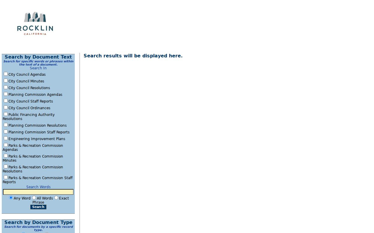
Use an APN, project name, or exact address phrase when possible. Minutes are the official meeting record, and the portal warns that an ordinance or resolution may later be amended, rescinded, repealed, or readopted.
Rocklin introduced its current eTRAKiT system in 2025 for Building, Planning, Fire, and Public Works. The Rocklin Building Division supplies the department context for permit-service questions. eTRAKiT fields include Permit Type, Short Description, Job Value, Additional Information, Location, Property Owner and Contractor checkboxes, Attachments, and Next Step. Registered users can upload plans, pay, view or print permits, check status, and schedule inspections. Anonymous search fields were not verified, so a city request remains the fallback.
The Rocklin eTRAKiT portal adds project context without becoming a resident list.
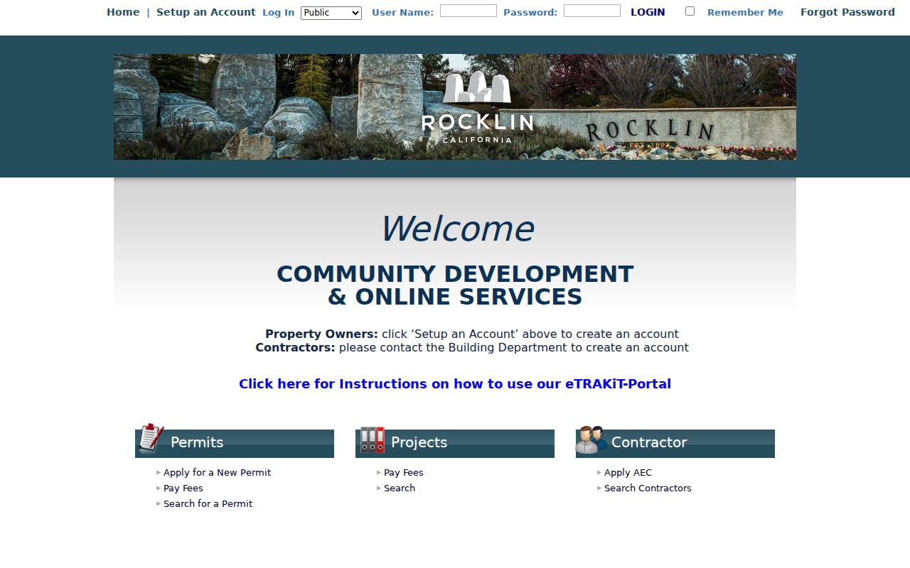
Use the project address and APN to link the permit, parcel, and city trail.
Rocklin Deeds Along a Street
The Placer County Clerk-Recorder at 3715 Atherton Road keeps the daily grantor/grantee index and scanned images at the public counter. Search Grantor or Grantee, document type, recording date range, document number, and book or page. The index is free, images are not online, and the counter is open Monday through Friday, 8 a.m. to 4 p.m. Recording is 530-886-5600; clerk service is 530-886-5610.
For a street directory, start with the current owner as a possible grantee, then follow the prior grantor. Confirm the same APN, lot, block, or legal description. A deed of trust concerns financing, a quitclaim may reflect family or title cleanup, and a trust transfer may change the grantee without showing a change in occupants.
Copies cost $2 for the first page, $1 for each additional page, and $2 for certification. The Clerk-Recorder fee schedule is the place to recheck those amounts before ordering. The exact online-index starting year was not stated. When a web reference ends, use the counter, older deed books, or archive assistance.
Note: A recording date marks acceptance into the public record; it does not prove the execution date or the date a household moved.
Historic Rocklin Street Maps and Lots
Current parcel lines are not the whole story behind an older street. Placer's map gateway offers current and historic assessor maps, GIS, and recorded-map paths. Compare the modern APN and legal description with older map-book references when a subdivision, rural locality, or street label appears in a deed or newspaper.
A plat is a recorded subdivision map that sets out lots, blocks, and related land descriptions. A parcel is the assessor's tax unit. A situs address is the physical location used for the parcel. A criss-cross directory is an address-based or reverse directory that can point from a street address to a name rather than the other way around.
Record terms. Use the parcel and APN to find the tax record, the situs to place the property, the plat or deed to test the legal lot, and a criss-cross directory to look for a dated household clue. These labels overlap in daily speech but are not interchangeable.
No Rocklin street-renumbering year is verified. If an older address fails, compare its legal description, map, locality, and nearby names instead of inventing a history.
Reading a Rocklin Street Directory
Address-based directories can fill the gap between ownership and a household snapshot. Rocklin Library offers Ancestry Library Edition in the branch, with city-directory, census, vital, passenger, naturalization, military, and related content. The California History Room holds telephone books, city directories, newspapers, maps, county histories, and genealogy files. Ask for Rocklin, Roseville, Auburn, Placer County, and rural-route titles.
No standalone Rocklin directory run is verified. Do not state first or last years without the title page and volume. The Rocklin Directory Book page follows the verified 1861 county item and library routes.
A criss-cross search should record volume, year, printed address, name, and abbreviation key. Pair it with the parcel ledger. An entry is a publisher's snapshot, not proof of everyone at the address.
When Rocklin Street Records Stop
A Rocklin street directory cannot reveal every person connected to a parcel. Assessor records focus on ownership and tax fields, documents show instrument parties, and permits show project participants. Household members, private contacts, utility accounts, delivery data, and protected addresses are outside those sources. Federal driver-data rules also keep motor-vehicle information out of a normal street search.
My Voter Status asks for a first name, last name, date of birth, and a current credential such as the last four digits of a California driver license or ID. It returns the submitting voter's status, not an open street browse. Elections Code section 2194 limits use, and Government Code section 7924.000 protects specified address, phone, email, identifier, prior-registration, and signature fields.
California Safe at Home can provide a substitute mailing address and confidential voter registration for qualifying people. A public result may therefore be incomplete by design. Treat a missing name as a limit of the record, not as proof that no one lives at the address.
Verify Rocklin Street Records
Before relying on a street result, check the APN, address, source date, and original custodian. Placer sends an owner notice after a grant or quitclaim deed in about three days, while assessor updates can lag weeks. A wrong APN may be a drafting error. Confirm the document number before calling it fraud.
The useful street directory is a dated ledger, not a stack of names. Keep the map, assessment, deed, permit or SIRE hit, and directory or census clue separate. This supports family history and civic research while respecting private life.
Lawful use. Rocklin address records are for lawful personal and public-record research. Do not use them to stalk, harass, intimidate, impersonate, or repeatedly contact a person; California Penal Code section 646.9 and Code of Civil Procedure section 527.6 address serious forms of this conduct.